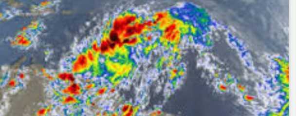
Information provided by the Dominica Met Service indicated that Dominica is expected to be affected by Potential Tropical Cyclone Number 9 from tonight through to Friday. This disturbance could become a tropical storm by tonight or tomorrow. This weather system is expected to bring heavy rainfall, thunderstorms and gusty winds up to tropical storm force along with rough sea conditions across the Leeward Islands and Dominica. The Met Service indicated that out of an abundance of caution, given great uncertainty with the system at this time, a Tropical Storm Warning has been issued for Dominica as of 2pm this afternoon. On the projected track, the center of this system is expected to pass about 75 miles to the north east of Dominica on Wednesday morning.
The ODM is advising the public that preparedness activities are paramount at this time and to exercise extreme caution over the next 24 to 48 hours.
CONCERNS FOR DOMINICA REGARDING THIS SYSTEM:


- FLASH FLOODING THAT COULD BE LIFE THREATENING
- LANDSLIDES
- GUSTY WINDS UP TO TROPICAL STORM STRENGTH
- ROUGH SEAS THAT CAN BE DANGEROUS FOR SEA USERS
ACTIONS RECOMMENDED FOR THE PUBLIC:
- Pay close attention to the information provided on the weather situation
- Ensure that important documents are protected in water proof containers in the event of flooding
- Check on your emergency kit and ensure it has the necessary supplies, including water, non-perishable food items, medication, battery operated radio, mask, sanitizer and rubbing alcohol;
- Be mindful of landslides during the inclement weather, especially in hilly terrains and roadways under cliffs and known hotspots such as under the Canefield Cliff, Tarreau, Bellevue Chopin Road, Imperial Road, Bois Diable;
- Stay alert during times of heavy rainfall. People who live along waterways including rivers, ravines and low-lying areas should be vigilant and be aware of their surroundings during this time. Be ready to move to a safe area if rising water is observed
- Limit outdoor activities where possible. Where necessary, use road ways and especially bridges with extreme caution during this time and be aware of water-covered roads and bridges.
- As previously mentioned, sheltering in place or neighbourly sheltering is encouraged. However, All Shelter Managers have been placed on alert. Find out where your emergency shelter is located (odm.gov.dm or Facebook: @ODMDominica1).
- Be mindful of flying debris during times of gusty winds especially across road ways and in elevated areas.
- Mariners and fisher-folks should secure their vessels this evening and remain in port on Wednesday
- Remember to obey COVID 19 Guidelines as we all do what is necessary to protect lives and property
Be reminded to get your information from official sources, the Met Service and the ODM and resist the urge to spread fake news.
As always we remind you to BE PREPARED. BE SAFE.