The Ministry of Agriculture, Fisheries, and the Blue and Green Economy, in collaboration with the Food and Agriculture Organization of the United Nations (FAO), has expanded on the groundbreaking Advanced Drone and Geospatial Analysis Training Program aimed at transforming agricultural monitoring and disaster risk management across Dominica. With technical and logistical support from FAO, this initiative is designed to strengthen national capacity in precision agriculture through the application of cutting-edge drone technology and geospatial data systems.
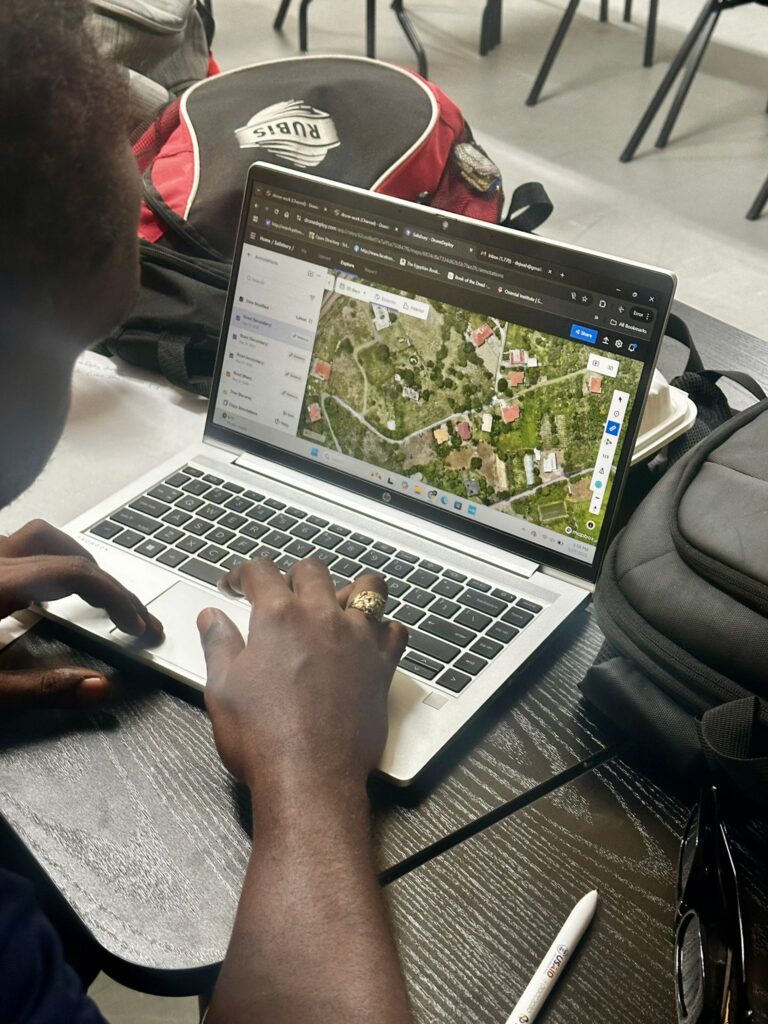
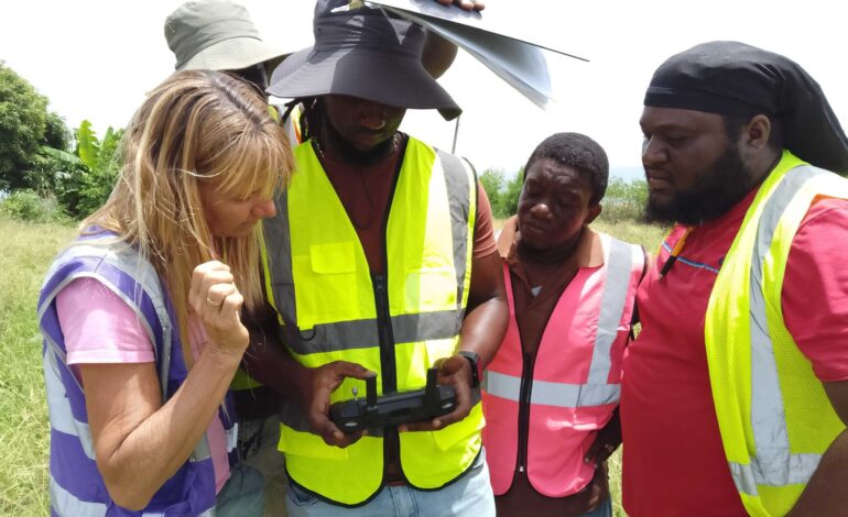
This intensive 10-week program expands on the successful foundation laid by the Ministry’s UAS (Uncrewed Aerial Systems) Drone Team, established in 2022. The new training cohort, consisting of twelve participants, including six drone pilots and six geospatial analysts, will benefit from a blended learning model. The curriculum combines in-person instruction, virtual coaching sessions, and field-based training, supported by Dr. Kim Baldwin Training Academy’s online platform.
Participants received specialized training in high-accuracy RTK drone operations, multispectral data collection, advanced GIS-based analysis, and the development of participatory monitoring strategies. Through this process, trainees will be empowered to plan and execute drone flight missions, analyze field data, and generate actionable insights to support national agricultural planning and climate resilience strategies.


FAO has played a critical role in facilitating this program by providing technical guidance, training equipment including advanced drones and laptops and supporting the coordination of all training components. This collaborative effort also involved a thorough review and update of Dominica’s national UAS Policy and Operations Manual to align with international best practices and ensure the safe and effective use of drone technology in agriculture.
The initiative will culminate in the development and presentation of Capstone Projects, where participants will showcase drone mapping results from selected agricultural demonstration sites. These outputs will serve as national benchmarks for monitoring and data-driven decision-making in agriculture and natural resource management.
“I’m incredibly excited to continue working with Dominica’s Ministry of Agriculture to advance this next phase of national drone innovation. Over the next two months, the Drone Team will be conducting advanced high-accuracy drone mapping and multispectral surveys across Dominica’s rugged terrain pushing the boundaries of what’s possible in agricultural monitoring and disaster risk reduction! This is not just training, it’s an opportunity for the MOA Drone Team to lead the region in using drone and geospatial technologies to inform smart, climate-resilient decision-making. They’ve already proven themselves, and I can’t wait to see what they achieve next.” Dr. Kim Baldwin, Director of Marine Spatial Information Solutions (MarSIS) Inc.
McCulley Ismael, extension office within the Ministry and pilot coordinator for the drone team stated “The launch of this advanced drone mapping training is a timely and essential step forward. As we work toward increasing our sector’s contribution to GDP by 2030, embracing UAV technology and building our pilot capacity will be critical. High-precision mapping, terrain modeling, and plant health analysis will greatly enhance our data collection and support more informed decision-making. This marks a significant leap for the Data Unit and the Ministry as a whole. We are grateful for these new tools and committed to delivering accurate, impactful results”.
By equipping local teams with the skills and tools to integrate drone-based data into real-world agricultural applications, this FAO-supported program represents a major step forward in building a resilient and innovative agricultural sector in Dominica. Final project outputs and policy recommendations will be shared with national and regional stakeholders, with an eye toward scaling up similar approaches across the Eastern Caribbean.