By Axel K. Auguiste
I lived within walking distance of the Atkinson Primary School, and I had to walk past a big yellow sign that said YOU ARE NOW LEAVING THE CARIB TERRITORY on my way to school. Then at almost every major holiday, my dad would take us on an island tour where most people would ask ¨how is Atkinson?¨ I read a newspaper article recently that reminded me of how easily most Dominicans use Salybia Constituency and the Kalinago Territory without thinking that there may be a difference.
First, with information at our fingertips, the average Dominican still say ¨I´m going up country to Atkinson¨ when what they really mean is, ¨I´m going to the Kalinago Territory¨, or the other way around. Also incredible is a news outlet use of Salybia Constituency interchangeably with Kalinago Territory. Of course, it´s no big deal since both communities share much in common, from school, to Carnival, shopping and public transportation, but when it comes to economic development, culture, and even mentality, there is a difference. The two communities that make up the constituency have a different history, culture and ethnic identity, yet constitute the two polling districts that make up the Salybia Constituency.
Secondly, too many, the political name is synonymous with the general name for the area between the Pagua River and Castle Bruce. Now, having been through a devastating hurricane, and like the rest of the country the Kalinago Territory is defining itself in all dimensions; including geographical boundaries, political systems, and charting a future that is distinctly indigenous. This is of great importance because the Kalinagos can now easily make the case that all the land between Castle Bruce and Pagua is the Kalinago Territory, irregardless of the non-Kalinago communities of Atkinson and Antrizle.
So, to help us clear up this little confusion, let us begin by looking at the Salybia Constituency:
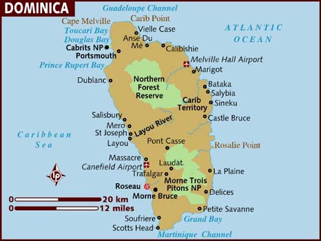
The Salybia Constituency consists of over 2500 voters from the two polling districts of Atkinson, and Salybia, it borders with the Marigot Constituency to the North and North-West, and the Castle Bruce Constituency to the South. (see fig. 1)
Fig.1
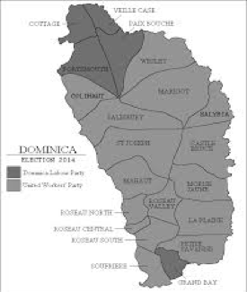
 Fig.2
Fig.2
The Kalinago Territory, on the other hand is the 3700+ acres of communal lands allocated to the remnant Kalinagos on the island who today has a population of around 3000. Hence, part of the confusion lies in its political structure with the Kalinago Territory having its Kalinago Council headed by a Chief, and Atkinson having its village council headed by a chairman, yet both form the Salybia Constituency which in turn is represented by a Parliamentary Representative of the ruling party of the national government. https://en.wikipedia.org/wiki/Carib_Territory (see fig. 2)
In conclusion, with the upcoming election of a new Parliamentary Representative, the Salybia Constituency remains divided along party lines, and having elected a new Chief, the Kalinago Territory as an indigenous people group, stands on the edge of both the past and the future. Finally, the challenge for us as the largest group of indigenous people in the Eastern Caribbean, is a clearly defined leadership structure on which we can rally in solidarity to enable us to navigate our identity within our national context and then within the broader context of globalization.

