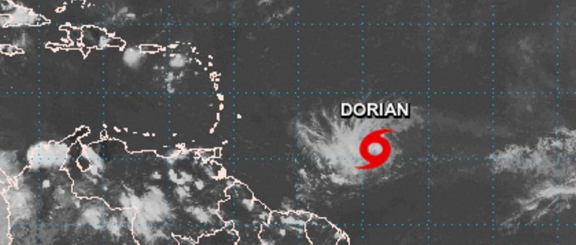
TROPICAL STORM WATCH REMAINS IN EFFECT FOR DOMINICA AT 5AM…DORIAN MOVING THROUGH THE WINDWARD ISLANDS WITH TROPICAL STORM-FORCE WINDS…
A Tropical Storm Watch means that tropical storm conditions are possible within the watch area, generally within 48 hours.
At 5am, the center of Tropical Storm Dorian was located near Latitude 13.5N and Longitude 60.7W approximately 30 miles south east of St Lucia (210km or 130 miles south east of Dominica). Dorian is moving toward the west-northwest near 13 mph (20 km/h) and this motion is expected to continue through tonight, followed by a turn toward the northwest on Wednesday.
On the forecast track, the center of Dorian is expected to move across the Windward Islands and into the Eastern Caribbean Sea in the next several hours.
Maximum sustained winds are near 50mph (85 km/h) with higher gusts. Tropical-storm-force winds extend outwards up to 45 miles (75 km) from the center.
The center of Dorian is projected to pass approximately 70 miles (110km) south of Dominica. Pockets of showers which could be moderate to heavy at times and thunderstorm activity generated by the system are projected to affect Dominica throughout most of today along with gusty winds possible up to tropical storm strength. Rainfall projection is for 2 to 4 inches (50-100mm) across Dominica with isolated higher amounts in elevated areas. Flash flooding and landslides are therefore possible.
Small craft operators and other sea users are advised to exercise extreme caution during the next 12 to 18 hours due to rough seas particularly along the south and west coasts. A small craft warning remains in effect until 6pm today.
Residents are advised to remain VIGILANT and keep updated on this system.
The Meteorological Service will continue to monitor the situation and provide updates.


